Boundary Landscapes – Cinder Cone Observation Point
I am currently using Kickstarter to help fund my next major project which involves making mammoth-plate wet collodion ambrotypes of landscape views of the boundary areas of southern Arizona. Specifically I am interested in the landscape of surveillance. For details and how you can become a member of this project please visit the Kickstarter project page.

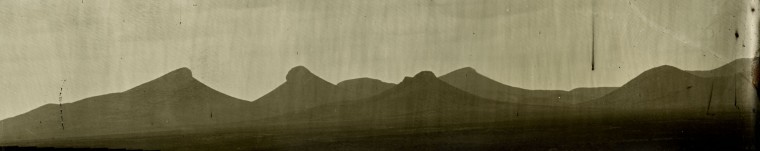
2,290 miles away from the place I currently call home is an desolate area of the country I once spent a large amount of my time immersed in, the borderlands of south Arizona. Although seemingly void of human life much of the time, many human eyes or man-made devices are keeping tabs on you as you travel through the area by land/air vehicle, walking, or pack animal. I am interested in the surveillance taking place in the timeless landscape of this area and the role the land plays.

An example of this is the cinder cone visible in the center of the satellite image above. This land feature is located apx. 1 1/2 mile north of the international border surrounded by miles of relatively flat terrain. This cinder cone has been used as a observation point (OP) for mobile camera, thermal, and radar platforms of the Border Patrol and National Guard since at least 2006

This closer view of the cone shows the natural cover provided by the rock projection at the top. This natural feature provides visual cover for vehicle mounted surveillance devices from the south. This is an example of one type of location I plan to photograph and photograph from.
Again for full details please visit this site.
